There are a large number of rivers and lakes in the Samara region. The Kuibyshev reservoir, filled with the Volga, occupies one of the first places in terms of area in Eurasia. Many tributaries of the Volga are independent, rather long rivers. In total, a little more than two hundred large and small rivers and streams flow through the Samara region.
Due to the geographical position of the Samara region on the border of the forest-steppe and steppe natural zones, the rivers of the region are different in their characteristics. In the northern part of the region, the rivers are fuller. The southern ones are characterized by low water levels, they have fewer tributaries and are smaller in size. All rivers of the Samara region flow in picturesque places. And if shipping and river tourism are developed along the Volga, independent tourist routes are popular on small rivers.
The longest rivers of the Samara region
List, photo with names and descriptions of the largest waterways in the region.
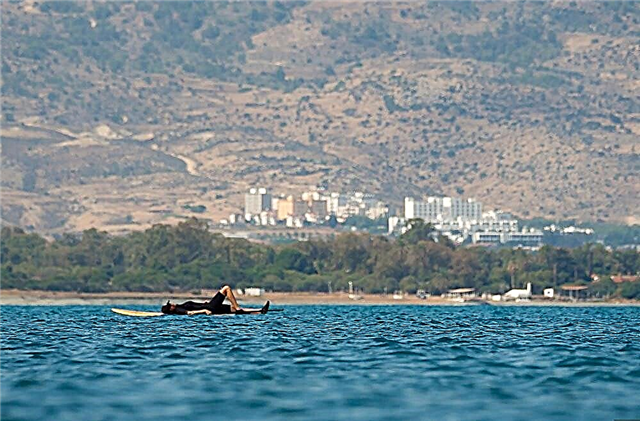
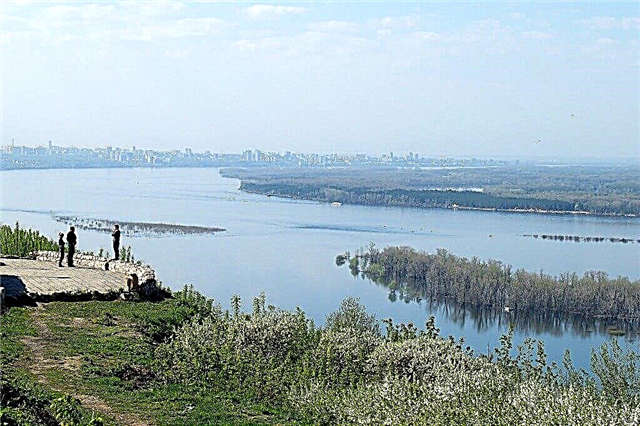
Volga
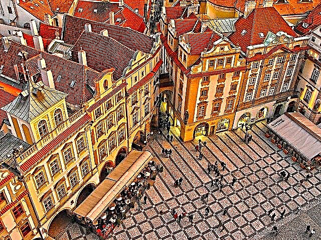
The length is more than three and a half thousand kilometers. This makes the Volga the largest, deepest river in Europe and one of the longest in the world. The Volga flows into the Caspian Sea, not into the ocean, and this is another feature of it. On the banks of the Volga there are national parks, state sanctuaries and reserves. Samara is located on the left bank of the Volga. The well-maintained Volga embankment in Samara allows tourists to fully enjoy the view of the great river.
The length of the river is 3530 km, in the Samara region - 340 km.

Read about the best places in the region: the main attractions of the Samara region.
Samara
It flows into the Volga near the city of Samara. In the floodplain of the river, about 6 km long, there are many lakes and channels. The picturesque Buzuluk forest is located on the bank of the river. The waters of the river were previously considered moderately polluted, but due to the closure of a large number of industrial enterprises on the banks of the river, its waters are becoming cleaner every year. The landmark of the river is the Sorochinskoye reservoir.
The length of the river is 594 km, in the Samara region - 175 km.

Big Kinel
It flows into the Samara River near the town of Kinel. The name of the river from the Tatar language is translated as "wide river". At the confluence with Samara, the width of the river reaches 50 meters, in narrow places - 15 meters. The river is flat, the current is slow. Therefore, the Bolshoy Kinel River is considered a good place for beginner rafters. There are no dangerous surprises in it, except for the abandoned dam and bridge.
The length of the river is 422 km, in the Samara region - 237 km.

The juice
It flows in two regions - Orenburg and Samara. A flat river with a slow flow. On the banks of the river there are only small villages and villages, there are no large cities and industrial enterprises. Therefore, the water in the Sok River is one of the cleanest in the region. It is home to different types of fish - pike, carp, roach, ide, many crayfish. The river is popular with fishermen, and winter ice fishing is especially popular on the Sok River.
The total length of the river is 363 km.

Big Cheremshan
Navigation on the river was stopped due to shallowing. The banks of the river are sandy, covered with mixed or coniferous forests. The lower reaches of the Bolshoi Cheremshan river was flooded during the construction of the Kuibyshev hydroelectric power station. The river is popular with novice kayak hikers in late spring. Then the flow of the river becomes faster due to the flood, and the banks are covered with blooming bird cherry. There are many parking spaces along the banks.
The length of the river is 336 km, in the Samara region - 84 km.

Chapaevka
Volga tributary. The depth of the river reaches three meters. The mouth of the Chapaevka River is a natural monument of regional significance. There are favorable conditions for fauna and flora, and many waterfowl live here. Fish come here to spawn. Hundreds of lakes are formed at the junction of Chapaevka with the Krivush channel. These picturesque places are called Matveyevsky manes. There are many large and small settlements on the banks of the river.
The total length of the river is 298 km.

Kondurcha
The largest tributary of the Sok River. It flows through Tatarstan and the Samara region. The river flows through the forest, most of the banks are overgrown with bushes, but there are also high banks on which a pine forest grows. The maximum depth is 1.5 meters. On the river there is the Kondurchinskoe reservoir, near the village of Slavkino. It is used to regulate river flow and fish farming. The name of the river is translated from the Turkic language as "beaver river".
The length of the river is 294 km, in the Samara region - 279 km.

Chagra
It flows in the Saratov and Samara regions. Chagra is a shallow steppe river, which can be forded most of the year. In summer, it partially dries up, forming small stretches. It is a tributary of the Volga. Its waters are used for irrigation, domestic and economic needs. The Chagra River, its appearance at different times of the year, is described by AN Tolstoy in the story "Nikita's Childhood". More than 20 species of fish live in the river.
The total length of the river is 251 km.

Maly Kinel
Tributary of the Bolshoi Kinel River. The source is located near the village of Glazovo in the Orenburg region. In high water, the depth of the river reaches three meters, the width is 20 meters. The Maly Kinel River forms several lakes up to 50 meters wide. Fishing on the river is not common. Most of the fishermen are residents of those villages that are located on the banks of the river.
The length of the river is 201 km., In the Samara region - 76 km.

Kutuluk
Bolshoi Kinel tributary. The source of the river is located in the area of the Buzuluk Bor national park. On the river there is the Kutuluk reservoir, the water from which is used for irrigation through the large Main Canal. Due to industrial facilities on the banks, the river has become shallow, its flow has become slower. The fish population in the Kutuluk River is not numerous. The banks of the river are covered with steppe vegetation.
The total length of the river is 144 km.

Surgut
Tributary of the Sok River. The mouth is located in the area of the village of Surgut. The source takes from the springs on the hills near the village of Seven Keys. Fishermen from villages located on the banks of the river catch carp and pike in Surgut. The banks of the river are covered with forests, there are sections of the banks with steppe grass. Surgut has several tributaries, the largest are Chesnokovka, Shunduk, Vyazovka. The total length of all tributaries of the river is 280 km.
The length of the river is 97 km.

Karalik
The name of the river goes back to the Turkic language. In translation - "dark". The river is fed by snow water. In summer, the river dries up a lot. The source of the river is streams with a spring origin. They originate in one of the ravines of the Kamennodolsk tract. A natural monument of regional significance is not only the source of the river itself, but also the steppe areas, "hanging" reed thickets in this place.
The length of the river is 84 km.

Sarbay
The Sarbai River flows into the Bolshoi Kinel River. It has several tributaries, the largest of them - Shumarka - has a length of 59 km. The slopes of the river valley are steep. The width of the valley at the mouth is 4 km. The banks of the river are mostly overgrown with meadow vegetation and bushes. The river is fed by snow, partly by spring. The name of the river is of Turkic origin, derived from a proper masculine name.
The length of the river is 81 km.

Bezenchuk
It is a tributary of the Volga. It is believed that the name of the river comes from the ancient name of the Pechenegs and means “river of the Pechenegs”. Since the river is fed mainly by precipitation, the river practically dries up in summer. A constant flow remains only in the lower reaches of the river. On the banks of the river, there is the regional center Bezenchuk and the village of Yekaterinovka, where the ground burial ground Yekaterininsky Cape is located.
The length of the river is 78 km.

Usa
Volga tributary. The maximum depth reaches three meters. 20 km of the river from Mezhdurechensk to the mouth are navigable. On the one hand, the banks of the river are swampy or covered with bushes, on the other - the bank is open, built up with summer cottages and occupied with vegetable gardens. In some places, the coastal slopes reach 90 meters. The waters of the Usa River are used for agriculture. There is an earthen dam on the river.
The total length of the river is 76 km.

Bolshaya Vyazovka
Tributary of the Chapaevka River. It flows through several small villages and villages and flows into Chapaevka near the village of Dergachi. There are 18 lakes in the river bed. Waterfowl live in small reservoirs - ducks, gray herons. The vegetation is diverse, especially at the source - meadow, marsh, steppe. The course of the river is slow, in some sections there is no current at all.
The length of the river is 73 km.

Black
It is a tributary of the Chagra River on the left side. It has two tributaries - Chernukha and Padovka. The river and its tributaries have a steppe, flat character. The flow of the Chyornenkaya river is slow. The banks of the river are gentle, there are practically no steep descents. The river is shallow. It reaches high water during the flood period or during heavy prolonged rains. Due to its small size, the river received its diminutive form of the name.
The length of the river is 72 km.

Lipovka
In the upper reaches of the river its other name is widespread - Santailovka. The source of the river is located near the village of Uspenka in the Kazenny forest. The mouth is near the village of Koshki, where Lipovka flows into the Kondurcha River. The banks of the river are steep, up to 5 meters high. During floods, the speed of the river flow increases several times and is 1.5 m / sec. It keeps flowing throughout the year, although the river is fed mainly from snow waters.
The length of the river is 70 km.

Karmala
Tributary of the Big Cheremshan. Karmala flows through two regions - Samara and Ulyanovsk. The name comes from the Tatar word "caramaly", which translates as "elm". The main tributary of the Karmala is the Kamyshleika River, 8 km long. Part of the area where the river flows is swampy. But most of the shores are covered with shrubs or small forests. In the waters of Karmala, there is an ordinary river fish.
The total length of the river is 66 km.

Rotten stream
It got its name because of the swampiness of the upper reaches of the river. The water is stagnant and has an unpleasant odor. Despite this, the river is popular with local fishermen. Perch, rudd, pike are well caught. Almost untouched nature stretches along the banks. The bottom of the river is muddy, and reeds grow in many places near the shore. The most convenient access to the river is located near the small village of Okean.
The length of the river is 32 km.