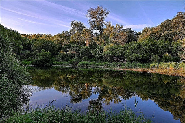
India is a country with rich natural resources. They play an important role in the continent as they provide food for millions of people. They are also sacred to the inhabitants of the country. The most revered river is the Ganges, which is located in the north of the country. But the Yamuna and the Indus are also important rivers. And it was from the Indus River that the name of the country originated. But now most of it is located in Pakistan. This was due to the division of India.
They are conventionally divided into three groups. The Himalayan rivers are found in the north of the country, and they remain deep throughout the year. Mixed ones are fed by rain and snow. But the Deccan rivers are fed by monsoons and here the water level is very unstable, therefore, flooding of the nearest settlements often occurs.
The longest rivers in India
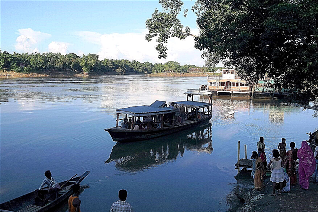
List, photo with names and descriptions of the main waterways of the country.
Indus
The largest river in South Asia. It is thanks to her that the country got its name. It starts high in the Himalayas at an altitude of 4557 meters, next to Lake Manasarovar, and then heads to the northwest of India. At the mouth, the Indus forms one of the world's largest deltas. Its waters are used for agriculture. And it is the Hindus who treat this river with special reverence, considering its waters sacred.
The length of the river is 3180 km, in India 502 km

Brahmaputra
It is one of the highest navigable rivers on the Earth. It originates in the northern part of the Himalayas at an altitude of 4860 meters. The main food is glaciers and heavy precipitation. A distinctive feature is that it is deep enough already at the beginning of the current. After passing through the plain, it flows into the Ganges. Since its waters are considered sacred, ablutions and burial rites are carried out on the banks.
The length of the river is 2896 km, in India - 955 km

Ganges
The largest river in South Asia, and also the third richest in the world. It is a symbol of Hinduism and is visited by pilgrimages from all over India. It originates in the western part of the Himalayas, on the Gangotri glacier. It crosses the Indo-Gangetic Plain and flows into the Bay of Bengal. If the source of the river is crystal clear, then closer to the bay the water is very polluted. At the same time, water is actively used for agriculture.
The length of the river is 2700 km, in India - 2400 km

Sutledge
It is the largest tributary of the Indus River. Its source is near Mount Kangrinboche in Tibet, at an altitude of 4630 meters. It flows along the Indo-Gangetic Plain, through the historical region of the Punjab and flows into the Indus. The amount of water is regulated by dams. This helps to avoid heavy spills during precipitation. Information about the river is also found in the ancient Vedas, which indicates its importance.
The length of the river is 1536 km, in India - 1050 km

Godavari
It is the second largest river in this country. It originates near the city of Trimbak, near the Arabian Sea. Then it flows through the eastern states and flows into the Bay of Bengal. There is a dam on the river, which helps to extract water for irrigation and supplies power plants. Since this is a sacred site for Hindus, there are several pilgrimage centers.
River length - 1465 km

Jamna
This is the largest tributary of the Ganges. It originates in the central part of the Himalayas, on the Yamunotri glacier. This place is considered sacred, so a Buddhist monastery is located not far from the source. Also flows near the capital of this country. It flows into the Ganges near the city of Allahabad. It has four main tributaries: Chambal, Singh, Betwa, Tons.
River length - 1376 km

Narmada
It is one of the most beautiful rivers in India. Its source is on the Amarkantak plateau. Having gained strength here, she falls from the cliff, in the form of the Kapidhara waterfall. Then flows westward through the Rift Valley. Since it is sacred, people make a complete detour around it. This is called Parikrama, is a kind of prayer, pilgrimage and is about 2600 km.
River length - 1310 km

Krishna
It is one of the longest rivers in India. Named after the most revered Indian deity. It originates in Maharashtra, at an altitude of 1300 meters. It flows into the Bay of Bengal. The delta of this river is the most fertile land in India. Its water is used for irrigation of fields and gardens. There are many holy places on this river, as this river is very revered among the Hindus. People come here for ablution and cleansing.
River length - 1300 km

Chinab
It is the right tributary of the Sutledge River in the Indus basin. Its other names are Trinab, Asikni, Chandrabhaga. The river was revered in antiquity, it is mentioned in the Vedas and other ancient scriptures. Its source is in the Himalayas. And then it flows into the Punjab Plain and flows into the Ravi River. It has two large tributaries: Ravi and Jelam. It is very important for agriculture and its waters are used for land reclamation.
The length of the river is 1100 km, in India - 433 km

Ghaghara
The most abundant tributary of the Ganges. It originates in the south of the Tibetan plateau next to the Mapam-Yumtso lake. Out on the plain, it merges with the Mohan River. Then it flows into the Ganges. The river receives its main nourishment from snow, rain and glaciers. Because of this, floods often occur in spring and summer. Its water is actively used for irrigation. In deep waters, the river is navigable.
The length of the river is 950 km, in India 515 km

Gomachi
The source of the river is in the foothills of the Himalayas in Pilibhita. Having gained strength, the river flows into the Ganges. On its length, there are 15 large cities and here it is used for urban water supply. But due to industrial waste, sewage, the river is very polluted. And during the rainy season, its level rises and this often leads to flooding of residential buildings located nearby.
River length - 900 km

Barrack
This river is seasonal, its size always depends on the amount of precipitation. And it only flows for a few months a year. The source of the river is on the Eritrean plateau next to Asmara. And then it flows westward, changing directions several times. All along it has many tributaries. And on the border with Bangladesh it is divided into two branches.
The length of the river is 900 km, in India - 524 km

Mahanadi
The beginning of the river is located in the northeast of the Deccan plateau. After passing through the plain, it flows into the Bay of Bengal. Floods are not uncommon in the vicinity of the river. There is shipping, but not along the entire length, but in certain areas. There is a dam on the river, which is the longest in the world. The waters of the river are also used to irrigate fields and gardens.
River length - 860 km

Chambal
It is a right tributary of the Jamna River. The source of the river is in the northern part of the Deccan plateau. Then it flows through the Malwa Plateau, the Indo-Gangetic Plain. Very dependent on rain food. A hydropower complex has been created on the river, which provides the nearest cities with electricity. There is also an irrigation system. Shipping is present in certain areas.
River length - 830 km

Kaveri
It is one of the largest rivers in India. Its source is on the slopes of the Western Ghats. Closer to the source, the river has many waterfalls. There are several hydroelectric power plants here. Also, the waters of this river are used for irrigation, so its banks are fertile. Certain sections are navigable. It is considered a sacred river and is worshiped by Hindus as a goddess.
River length - 800 km

Sleep
It is one of the tributaries of the Ganges River. The river originates from the Chota-Nagpur plateau. Then it moves along the valley near the foot of the Kaimur Mountains. In summer it has high floods and can be dangerous. Some of its sections are navigable. It is also actively used for irrigation of agricultural land.
River length - 780 km

Tapti
It is located in the central part of the country and is one of its largest rivers. And the source originates in the eastern side of the Satputra massif. Maintains an east-west direction, parallel to the Narmada River. Then it flows into the Gulf of Cambay.Half of the waterway is navigable.
River length - 720 km

Tungabhadra
Located in the southeast of the country. This river appeared as a result of the confluence of two small rivers: Tunga and Bhadra. It flows to the northeast and flows into Krishna, which then flows into the Bay of Bengal. During the rainy season, the Tungabhadra is quite deep and can be dangerous. It is considered sacred, therefore the Hindus perceive it as a manifestation of God on earth.
River length - 710 km

Rapti
The source of this river is in Nepal, high in the Himalayas. The river is highly susceptible to seasonal fluctuations, but this does not prevent it from being used for irrigating fields and orchards. It also has a hydroelectric power plant that provides electricity to small towns on its shores. And dams help regulate the water level during heavy rainfall. The river flows into the Ganges.
River length - 600 km

Damodar
The source of this river is located on the Chota-Nagpur plateau near the village of Chandwa. Then it takes a westerly direction and flows into the Hooghly River. During the rainy season, it feeds and becomes dangerous. However, nowadays, floods rarely occur on its shores. Mining takes place on the banks, so it is one of the most polluted rivers in this country. There are also several hydroelectric power plants.
River length - 592 km

Shayok
This is another of the many tributaries of the Indus. It originates from the Rimo I glacier, which is located in the Himalayan heights. And after the confluence with the Nubra River, it expands noticeably and flows to the Pangong ridge. Having made a sharp turn, the river turns into a loop. The fullness of this river depends on precipitation. And its waters are actively used for agriculture.
The length of the river is 550 km, in India - 394 km

Subarnarekha
Its distinctive feature is that it has many waterfalls and rapids. The largest waterfall, Khudru, is 98 meters high. The mention of this river can be found in ancient Indian Sanskrit. The river flows through several Indian states, along the Chota-Nagpur plate, Jharkhand. But its name stands for "Strip of gold".
River length - 470 km

Bias
The second name of this river is Vipasha. It is one of the many tributaries of the Indus. Formed in the Himalayan highlands, and near the city of Amritsar merges with the Sutlej River. Together with the other six rivers, it is part of the Indian Semirechye. Mentioned in the Vedas and is one of the most ancient rivers in India. Now it is heavily polluted, but this does not interfere with the use of its water for irrigation.
River length - 470 km

Subansiri
This river is located in the northeast of the country and flows through several states: Assam, Arunachal Pradesh. It is the most important tributary of the Brahmaputra. The source of the river is located in the Himalayas. And then it follows south through the Assam Valley. Then it flows into the Brahmaputra.
The length of the river is 442 km, in India - 320 km

Sabarmati
Located in the western part of the country. The beginning of the river is located on the Aravali ridge in the Udaipur region. The river flows into the Gulf of Cambay, which is considered part of the Arabian Sea. Most of the area where the river flows is dry. It has several tributaries with reservoirs and dams. But the water here is subject to seasonal fluctuations due to the large amount of rainfall.
River length - 371 km